

Posts with tag 'Why We Love Central Oregon'
Subscribe and receive email notifications of new blog posts.
 RSS Feed
21
A Perfect Day in Bend: How Locals Spend Their Weekend
Experience the Bend lifestyle through the eyes of those who call it home. From sunrise coffee and mountain views to riverside adventures and craft cocktails downtown, a weekend in Bend is about living fully — outdoors, connected, and inspired.
Morning: Coffee, Sunshine, and River Trails
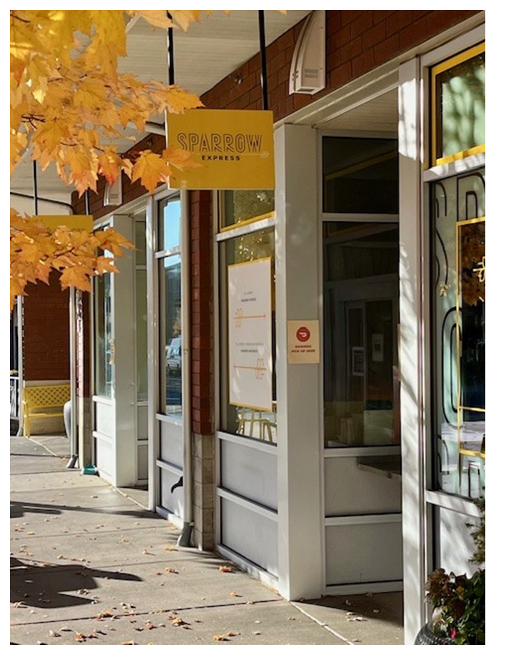 Bend mornings start early — not out of obligation, but out of excitement. The light over the Cascades is too beautiful to sleep through, and the smell of fresh-roasted coffee from local cafés is irresistible. Grab a morning latte at Sparrow Bakery, where locals linger ov...
8
Bend Premier Real Estate | October 2025 Newsletter
What's in the October 2025 Bend Premier Newsletter?
- Lower Mortgage Rates are Making a Difference
- Pumpkin Pancakes
- Get Spooky While Saving: Budget-Friendly Halloween Decor Ideas
- Carl Lake is a Little Known Hike
- 3 Advantages of Buying a Newly Built Home Today
3
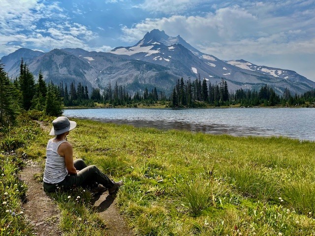
Hike to Carl Lake and Beyond in Oregon's Mt Jefferson Wilderness
The Hike to Carl Lake is Little Known
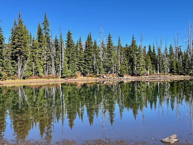
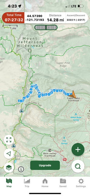
Many in Central Oregon know of the hike to Three Fingered Jack via Canyon Meadow. This trailhead to this hike is accessed from Jack Lake which is at the end of Forest Service Road 1234 in the Mt Jefferson Wilderness. Forest Service Road 1234 splits off Forest Service Road 1230 roughly two miles off paved Jack Lake Road. If instead of turning on 1234 to the Jack Lake Trailhead, people wanting a different experience can continue on 1230 for seven miles to reach the Cabot Lake (Carl Lake) trailhead (the last two miles of this road is rough).
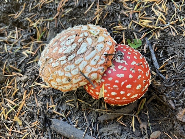
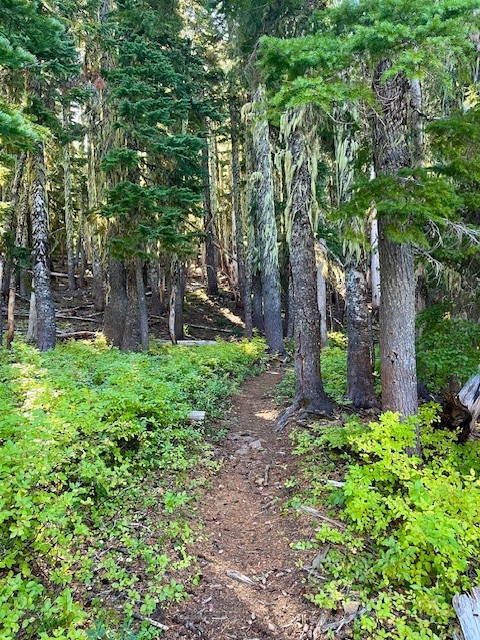
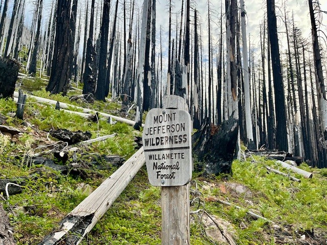
The first mile and a half of this hike is through the recovering burned forest of the B & B complex fire of 2003, but after that, the hike is in old growth forest. Two miles in the trail passes an overgrown and uncleared spur that can take hikers to Cabot Lake, a lovely forest lake. The trail has numerous blueberry bushes and in the fall, interesting mushrooms. After a series of switchbacks climbing a ridge, the trail levels out and passes three small unnamed lakes until at five miles the trail reaches Carl Lake.
 |
 |
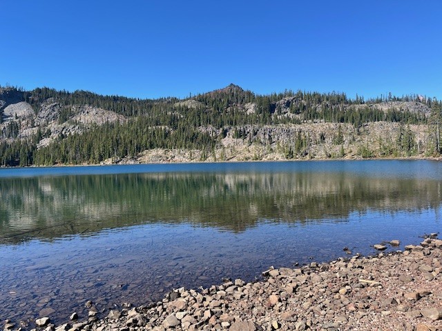
Carl Lake is a lovely, deep blue, glaciated, trout filled alpine lake. There are also many camping spots dotted around the lake for those who wish to spend some time enjoying the area. For those wishing more hiking challenges, past the south side of the lake is a trail that goes to Shirley Lake and beyond it, climbs to reach the Pacific Crest Trail. Two tenths of a mile south on the PCT is a spur trail trail west that hikers can use to summit South Cinder Cone. For those who do, the views toward Mt. Jefferson to the north and Three Fingered Jack to the south are truly outstanding.
 |
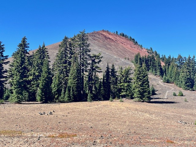 |
Day hikers can enjoy the entire trip from the trailhead up South Cinder Cone and back in 14.28 miles and see very few if any people.
 |
 |
10
Bend Premier Real Estate | September 2025 Newsletter
What's in the September 2025 Bend Premier Newsletter?
- It's a Mixed Market for Bend Home Sales
- Butternut Squash Soup
- Why September is the Best Month to Paint Your Home's Exterior
- Jefferson Park Has Had 2 Fires in 8 Years
- What You Need to Know About Concessions
4
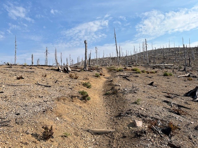
Jefferson Park in the Mt Jefferson Wilderness is Still Beautiful Despite Fires
Two Fires in Eight Years Have Impacted Jefferson Park
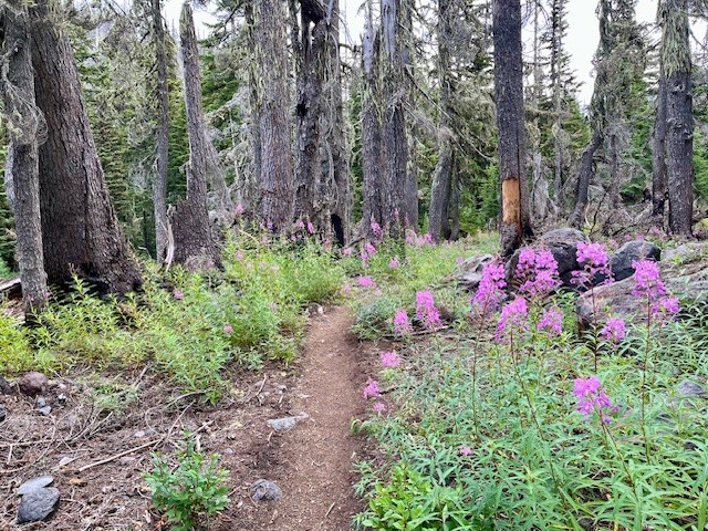
For those who enjoy hiking in the Mt. Jefferson Wilderness, one of the most treasured locations to see has been Jefferson Park. Located at the base of Mt. Jefferson, Oregon's second tallest peak, the beauty of the meadow and the reflection of Mt. Jefferson in the multiple lakes has been the destination for campers and day hikers for many years. In 2017, the Whitewater Fire destroyed 11,500 acres, much of which was near the Whitewater trailhead and surrounding forest. However, in 2020, the devastating Santiam Fire, which ballooned to 402,274 acres and destroyed several towns, over 1500 structures and killed 5 people was among the worst fires in Oregon's history. Access to Jefferson Park remained closed for several years after this fire, but has since reopened.
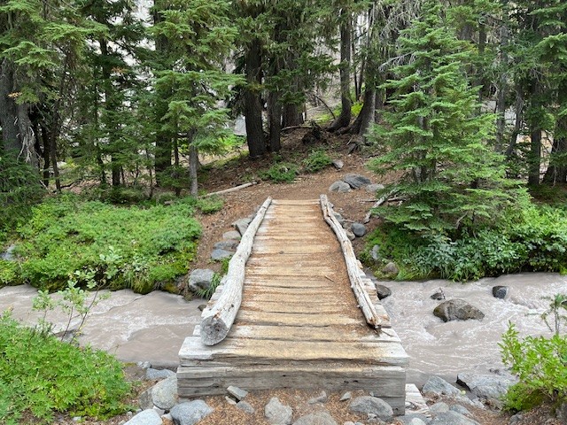
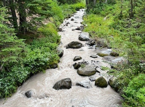
The hike to Jefferson Park from the Whitewater trailhead takes hikers through 4 miles of burned forest before coming to Whitewater Creek where hikers need to cross via stones or logs laid across the creek. There are signs of life returning to the burned area, although it will take many decades before the forest is restored to what it was before the fires. The Whitewater trail joins with the Pacific Crest Trail before reaching the park and once again hikers have to cross Whitewater Creek, this time via a bridge.
 |
 |
 |
 |
It is shortly after crossing the bridge that hikers actually enter the meadow which is Jefferson Park. There are sections of the surrounding forest that are burned, but also many sections which remain beautiful and alive. Several side paths provide access to Bay, Scout, Park and Rock Lakes, all clean and clear alpine lakes with sandy bottoms with many camping areas nearby. Russell Lake is at the far western end of the park and provides outstanding reflections of Mt. Jefferson. There are campsites around Russell Lake as well. For those who hike from the Whitewater Trailhead to Russell Lake and back, plan on 13 miles and over 2300 feet of elevation gain.
 |
 |
Privacy Policy / DMCA Notice / ADA Accessibility