

Posts with tag 'Places to See in Central Oregon'
Subscribe and receive email notifications of new blog posts.
 RSS Feed
14
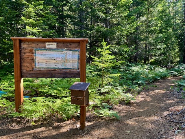
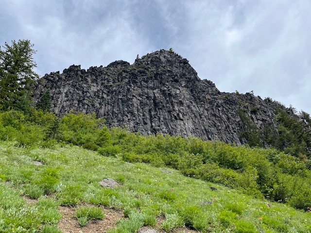
Climb Maxwell Butte For Unobstructed Cascade Views
Maxwell Butte is a Little Known Central Oregon Hike
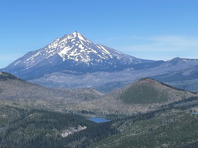
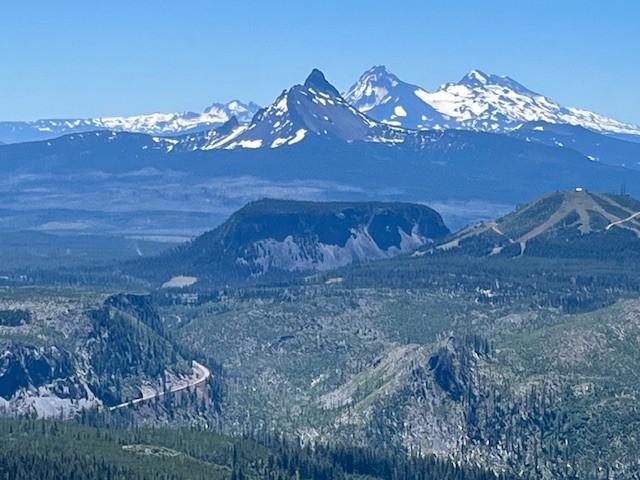
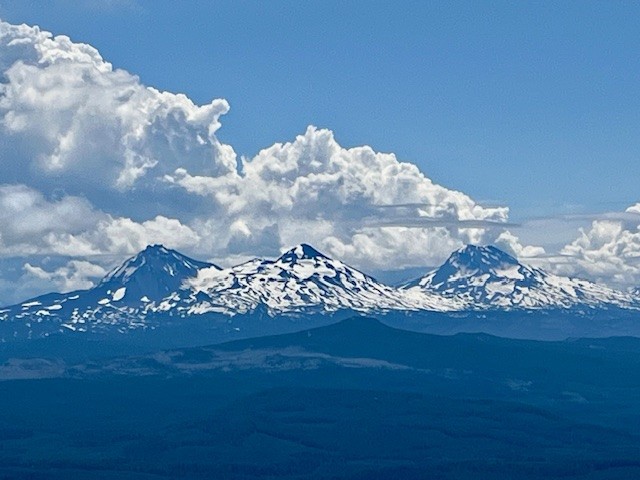
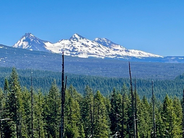
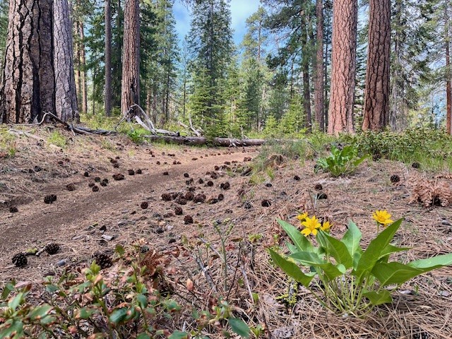
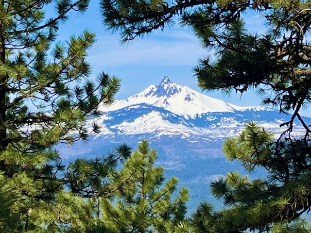
While the higher Cascade Mountain hikes were still snow covered in mid July 2025, Maxwell Butte was snow free and offered spectacular mountain views. On July 12, only one other hiker was seen the entire day and while mosquitoes were a problem in the morning, they were gone once the sun rose. The hike from the trail head to the top of Maxwell Butte is a moderate, forested trek with 2453 feet of elevation gain over 5.10 miles one way; the last steep mile up the butte can be more challenging with switchbacks on pumice on parts of the path. However, the higher hikers get, the more the views of Mt. Washington, North and Middle Sister, The Husband and the Wife become visible until near the top, the full view of Tam McArthur Rim and Broken Top can also be seen. Hoodoo Ski Bowl and Hayrick Butte really stand out as well in the topography in a way that is not visible from lower elevations. Looking east, Three Fingered Jack dominates the skyline and north, fabulous views of Mt. Jefferson, Mt. Hood and the eight lakes basin are seen.
For those wanting a good, challenging 10+ mile hike that is rarely crowded and does not require anything other than a self-issued day pass at the trail head, Maxwell Butte may be a good option, especially when the passes for the most popular high Cascade hikes are not available.
 |
 |
 |
 |
 |
 |
10
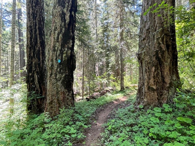
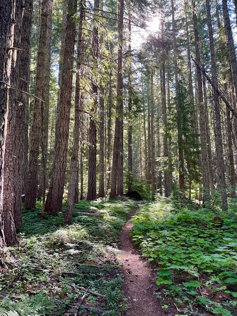
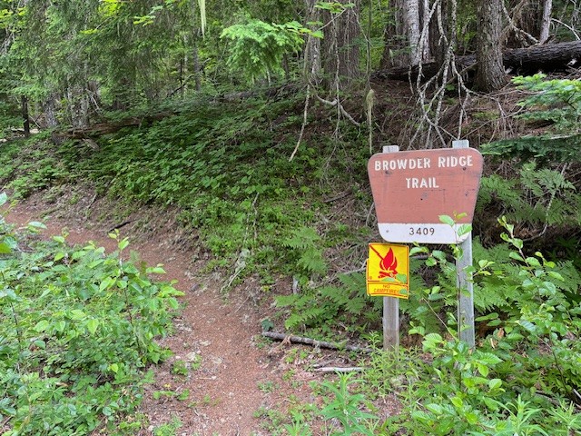
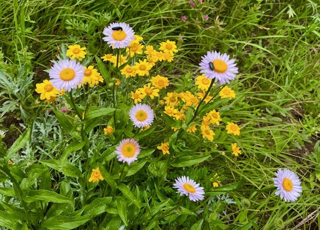
Browder Ridge Hike Is Blooming!
The Wildflowers and Views Are Fabulous at Browder Ridge
Iron Mountain remains one of the favored Central Oregon wildflower hikes that many people on both sides of the Cascades enjoy yearly. However, the lesser known and less traveled Browder Ridge offers even more wildflowers and views unseen from Iron Mountain. The easiest access to Browder Ridge Trail is near the Iron Mountain trailhead a few miles up paved forest service road 15.
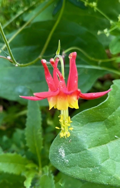
In early July 2025, the wildflowers were blooming and the air was clear, providing outstanding views of multiple peaks of the Cascades. The hike from the trailhead off forest service road 15 climbs over 2300 feet to the peak at the top of Browder Ridge at a distance slightly more than six miles one direction. Varied shade loving and sun loving wildflowers can be seen throughout the hike.
 |
 |
 |
 |
 |
 |
30
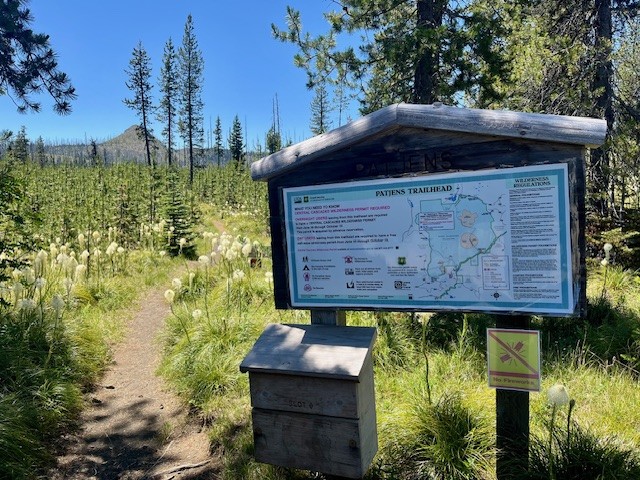
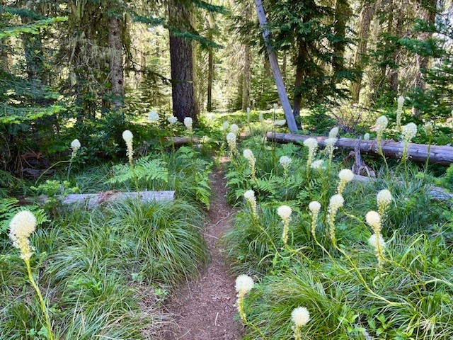
The Bear Grass is Blooming at Patjens Lakes Loop Trail
Patjens Lakes Loop Trail is a Moderate Hike in the Mt. Washington Wilderness
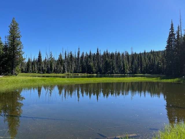
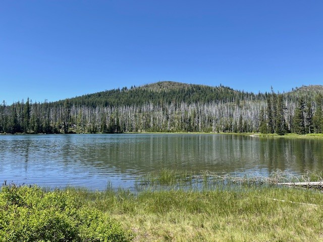
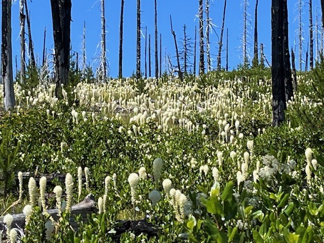
For those who are looking for a Bear grass hike in Central Oregon, Patjens Lakes Loop Trail is hard to beat the end of June 2025. When hikers leave Hwy 20 to drive to the paved trailhead near the end of Big Lake Road, blooming Bear grass can be seen on each side of the road, a great indicator that the hike has a significant amount of it seen during the trek. Patjens Lakes Loop Trail runs adjacent to Big Lake at Santiam Pass before it leaves the lake to run south into the Mt. Washington Wilderness where it skirts the 4 small Patjens Lakes before returning to the starting point next to Big Lake. There are still signs of the B & B complex fire of 2003 which burned over 90,000 acres in the Mt Washington and Mt Jefferson Wildernesses, running along the crest of the Cascades. However devastating the fire was to the area, the burned areas provided more growing areas to sun-loving plants, such as Bear grass.
 |
 |
 |
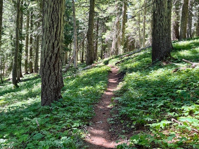 |
Areas untouched by the fire retain the lush undergrowth and tall trees of most Western Oregon old growth forests, complete with shade-loving plants and many birds. The last two miles of the hike, however, are in the burned area. Part of the path climbs a ridge from which hikers have amazing views of the Three Sisters, Black Crater, Hoodoo Ski Area, Three Fingered Jack and Mt. Washington. The slope of this ridge is covered with Bear grass and the Cascade views would not be evident had the area remained unburned.
The entire hike is under 7 miles with a little over 700 feet of elevation gain, considered by many a moderate route.
 |
 |
23
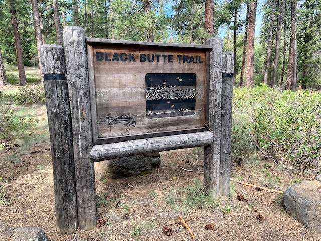
The Historic Black Butte Hike Can Be Challenging
There Are Two Trailheads to Summit Black Butte
Many people will hike to the summit of Black Butte during the summer. It is an iconic volcano located just outside of Sisters next to Black Butte Resort which challenges both visitors and locals. Most people will take the gravel road which transitions into a terrible dirt road to the upper trailhead which is located 1500 feet below the summit. Hikers who start here will find a limited space parking area complete with facilities which require a current forest pass. Those who really want to challenge themselves can start at the base of Black Butte at the historic trail head located near Camp Sherman. The road to this trailhead is mostly paved until the turn off to the parking area so hikers avoid driving over challenging dirt roads before they start their trek. No parking pass but very limited parking available.
 |
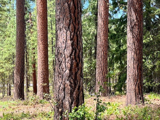 |
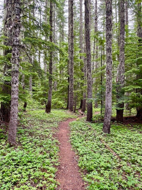
For those hiking the historic route, the trail gradually climbs as hikers pass through the old growth forest located at the base of Black Butte. In May, 2025, early signs of spring were evident with blooming wildflowers. After roughly 3/4 of a mile, the path steepens and hikers start climbing Black Butte. Peek-a-boo views of Black Butte Ranch, Suttle Lake, and the Cascades can be seen through the tall Ponderosa Pines.
 |
 |
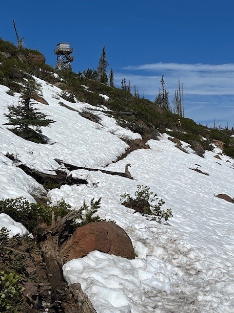
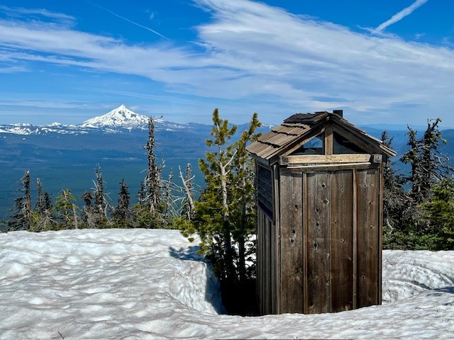
After 3 miles the Historic Black Butte Trail reaches the upper trailhead and the last two mile of the hike is along this route. At the top of Black Butte in the middle of May, 2025, snow patches remained which were easily crossed. The top of the Butte was relatively snow free with all structures still locked and inaccessible to early visitors.
 |
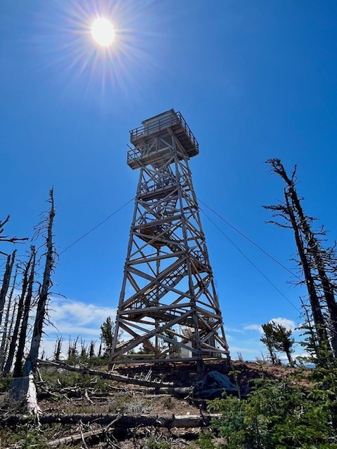 |
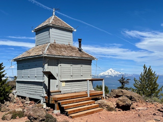
Hikers can enjoy the top of Black Butte with amazing Cascade Views. On a clear day, as many as 13 peaks can be seen from Mt. Bachelor in the south all the way to Mt. Adams in Washington to the north. After spending time at the summit, hikers need to descend back to the trail head in Camp Sherman. All in all, the historic Black Butte Trail is over 10 miles with 3400 feet of elevation gain in the ascending 5 miles.
 |
 |
13
Bend Premier Real Estate | May 2025 Newsletter
What's in the March 2025 Bend Premier Newsletter?
- Bend Home Inventory Up With Closings Down
- Dutch Baby Pancake
- Outdoor Furniture Revival: How to Clean, Restore and Prep for Patio Season
- Alder Springs Hike in Central Oregon
- You Finally Have More Options for Your Move
Privacy Policy / DMCA Notice / ADA Accessibility