

Posts in category 'Why We Love Central Oregon'
Subscribe and receive email notifications of new blog posts.
 RSS Feed
22
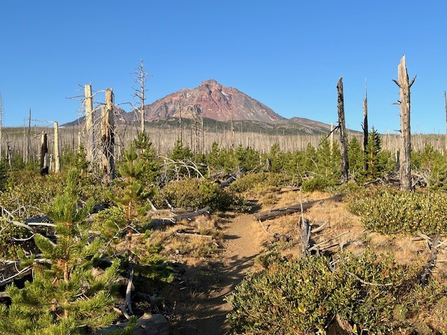
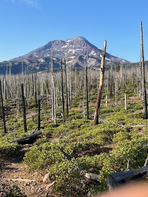
Hayden Glacier Hike on Middle Sister is a Challenge
Take the Climbers' Trail to Reach Hayden Glacier
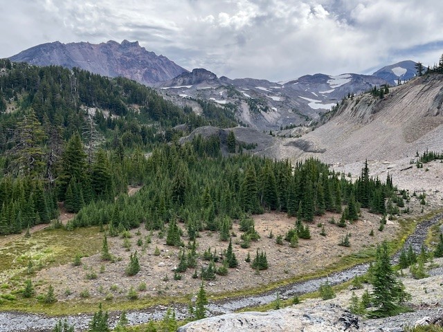
For Central Oregon hikers looking for something different that does not require a paid permit, the climbers' trail on Middle Sister is well worth it. Most hikers would start in the burned forest at the Pole Creek Trailhead located off forest service road 15 outside of Sisters (the parking at the trailhead requires $5 payment or a forest pass). After hiking the trail to the junction with Green Lakes Trail 17, trekkers continue on Trail 17 toward Park Meadow. Shortly after crossing Soap Creek is the junction with Camp Lake which hikers should take to reach the unmarked junction with the Climbers' Trail. If hikers miss this trail, it loops with another section of the Camp Lake trail near one of the branches of Wychus Creek which hikers to Camp Lake have to cross. Climbers don't cross the creek, but instead hike upstream toward Middle Sister.
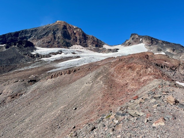
Regardless of the looped trail route chosen, they join on the moraine just under Hayden Glacier. Both are steep, difficult hikes with loose pumice and boulders to traverse. For those who plan on summiting Middle or North Sister, Hayden Glacier is just another geological feature to pass by before the summiting. For those not wishing to go further, the Cascade views from the glacier are amazing.
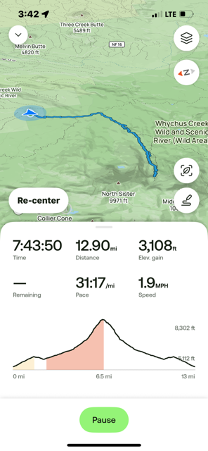
For those starting at the Pole Creek Trailhead and hiking to the glacier but no further, plan on a full day, climbing over 3100 feet and roughly 13 miles.
 |
 |
 |
 |
4
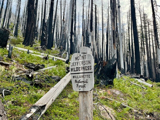
Jefferson Park in the Mt Jefferson Wilderness is Still Beautiful Despite Fires
Two Fires in Eight Years Have Impacted Jefferson Park
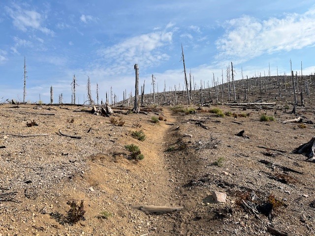
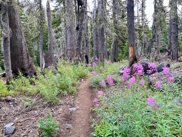
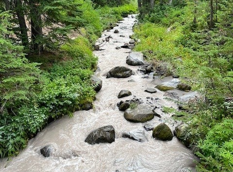
For those who enjoy hiking in the Mt. Jefferson Wilderness, one of the most treasured locations to see has been Jefferson Park. Located at the base of Mt. Jefferson, Oregon's second tallest peak, the beauty of the meadow and the reflection of Mt. Jefferson in the multiple lakes has been the destination for campers and day hikers for many years. In 2017, the Whitewater Fire destroyed 11,500 acres, much of which was near the Whitewater trailhead and surrounding forest. However, in 2020, the devastating Santiam Fire, which ballooned to 402,274 acres and destroyed several towns, over 1500 structures and killed 5 people was among the worst fires in Oregon's history. Access to Jefferson Park remained closed for several years after this fire, but has since reopened.
The hike to Jefferson Park from the Whitewater trailhead takes hikers through 4 miles of burned forest before coming to Whitewater Creek where hikers need to cross via stones or logs laid across the creek. There are signs of life returning to the burned area, although it will take many decades before the forest is restored to what it was before the fires. The Whitewater trail joins with the Pacific Crest Trail before reaching the park and once again hikers have to cross Whitewater Creek, this time via a bridge.
 |
 |
 |
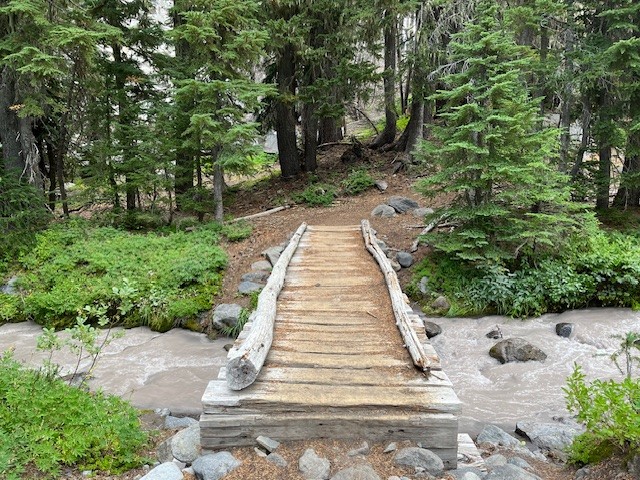 |
It is shortly after crossing the bridge that hikers actually enter the meadow which is Jefferson Park. There are sections of the surrounding forest that are burned, but also many sections which remain beautiful and alive. Several side paths provide access to Bay, Scout, Park and Rock Lakes, all clean and clear alpine lakes with sandy bottoms with many camping areas nearby. Russell Lake is at the far western end of the park and provides outstanding reflections of Mt. Jefferson. There are campsites around Russell Lake as well. For those who hike from the Whitewater Trailhead to Russell Lake and back, plan on 13 miles and over 2300 feet of elevation gain.
 |
 |
27
The Obsidian Trail is Stunning in 2025
The Obsidian Trail is a Favorite Central Oregon Hike
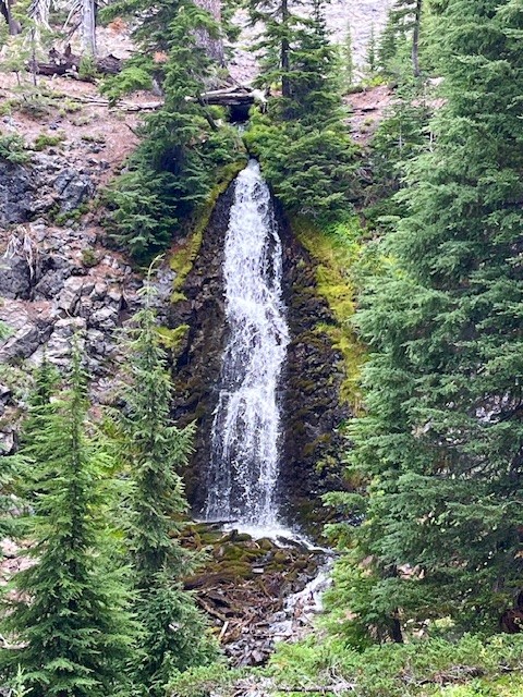
Before the National Forest Service required passes in 2021 for the most popular Central Oregon hikes, the Obsidian Trail had such a huge demand that trail passes were in place for many years earlier. The Obsidian Trail takes hikers from the trailhead off the seasonal McKenzie Pass Highway 242 up to the Pacific Crest Trail and through an area known for the obsidian rock that covers the ground. Before reaching the rock, hikers pass through wooded forest, climb lava flows, travel by Obsidian Falls and then reach the relatively flat land of the obsidian area.
 |
 |
There is a beautiful view point overlooking the climbing trail which some may take to summit Middle Sister. It is a logical place to stop and enjoy a snack or lunch before proceeding on to an area known as Sunshine which was a place many Pacific Crest Trail hikers or those planning to summit Middle Sister early morning would spend the night. Currently that location is undergoing restoration and not available for camping.
 |
 |
All in all, for those who wish to hike the loop from the Obsidian Trailhead, travel to Sunshine and return via Glacier Way (a side path that joins with the Pacific Crest Trail and avoids Obsidian Falls), the entire trek will cover about 11.5 miles and have over 2100 feet of elevation gain.
 |
 |
12
Hidden Treasures in the Three Sisters Wilderness in the Central Oregon Cascades
Leave the Path to Find Little Seen Tarn Lakes Above Green Lakes
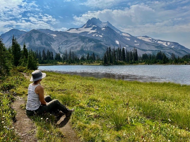
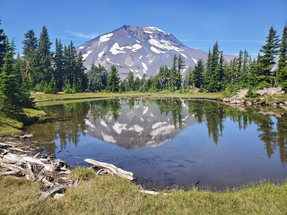
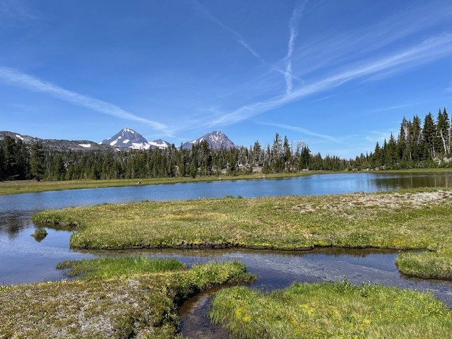
There are hidden treasures in the Three Sisters Wilderness which can be found for those willing to leave the path and follow a compass or GPS to locate them. In particular, there are several beautiful tarn lakes located roughly a half mile off the Green Lakes trail which connects the Green Lakes valley with Park Meadow over the pass between South Sister and Broken Top. There is no path to these lakes, but people good with following a downloaded map can find them. The first four lakes can mirror views of South Sister and their general location can provide views toward Golden Lake as well.
 |
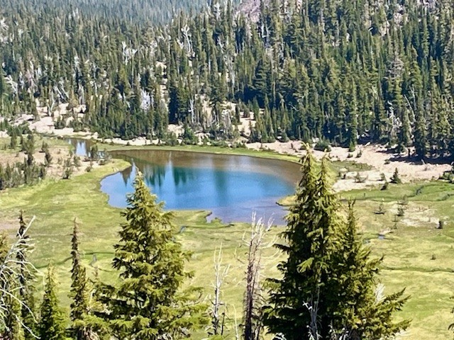 |
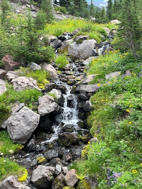
Past the four lakes walking toward Broken Top, hikers can follow a general topography line on a map and find the other two tarn lakes located just below Broken Top. These two lakes can more easily be accessed by following the path next to the creek which flows into Golden Lake. Both of these tarn lakes are located in a cirque bordered by a moraine. On the lower lake, the beautiful blue water was flowing over the top of the moraine forming a waterfall flowing into the creek below in early August 2025. At other times, the water which flows into the creek comes out of a spring at the base of the moraine. At the upper lake, sometimes the voices of people on the top of the ridge overlooking Broken Top's No Name Lake can be heard, although they are not seen due to obstruction from topography and vegetation.
 |
 |
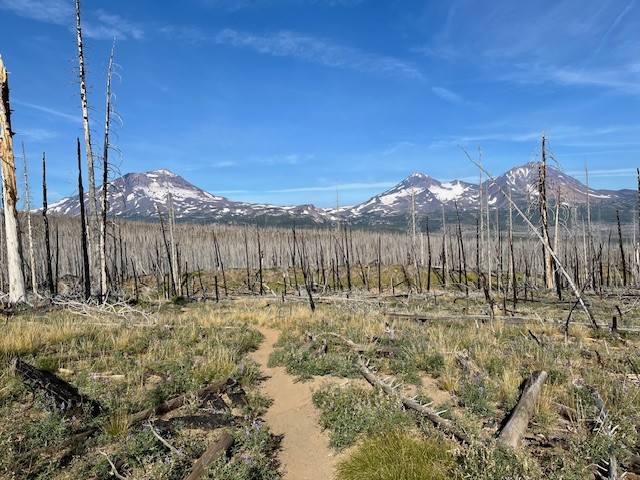
The more direct route back to the trail is following the path down the creek to Golden Lake and from there, rejoining the Green Lakes Trail. Hikers can either return to Green Lakes over the pass or travel northeast to Park Meadow and from there to the Park Meadow trail head near Three Creeks. This second option will involve hiking through over 4.5 miles of burned forest, however. Both methods can be done in a long day, those coming from Green Lakes hiking over 18 miles and those coming from Park Meadow close to 17 miles. Others could pack in camping supplies and better explore and enjoy the day in the area.
 |
 |
7
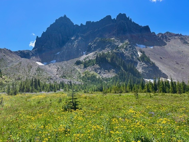
Canyon Meadow and Three Fingered Jack are Wonderful Summer Central Oregon Hikes
The Wildflowers are Abundant in Central Oregon's Canyon Meadow in the Mt. Jefferson Wilderness
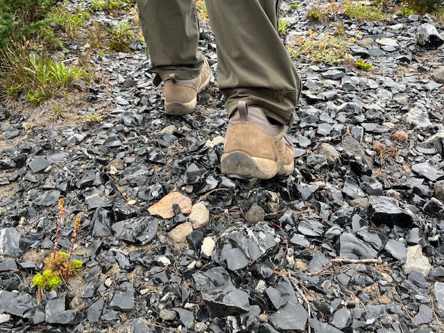
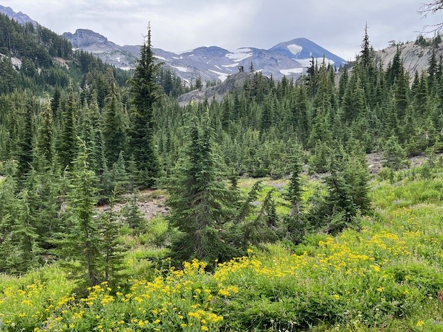
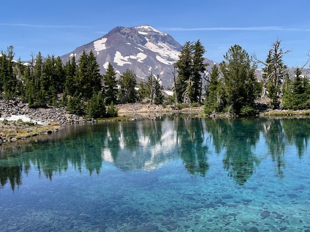
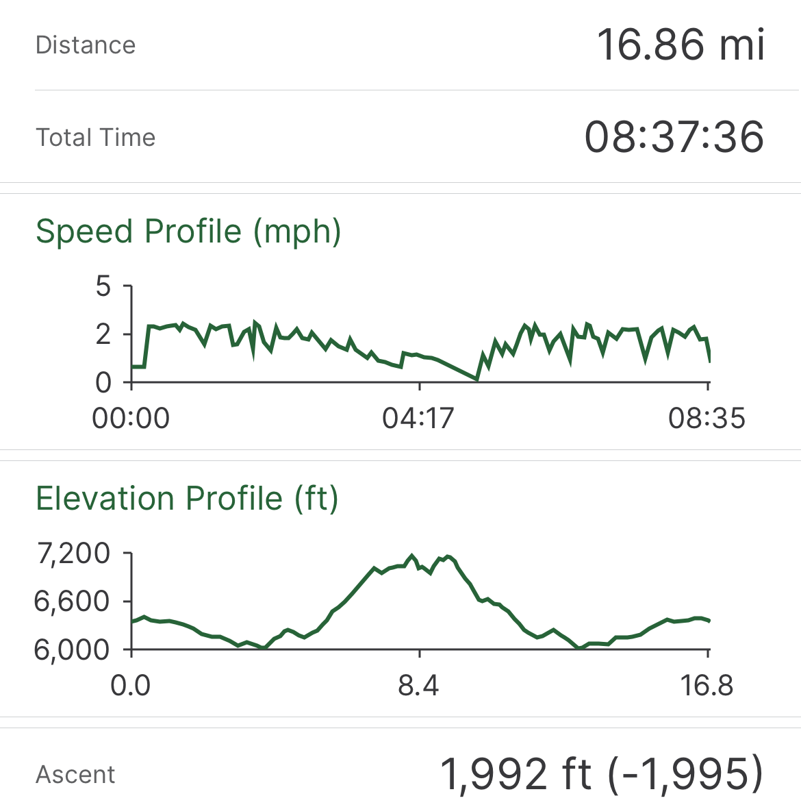
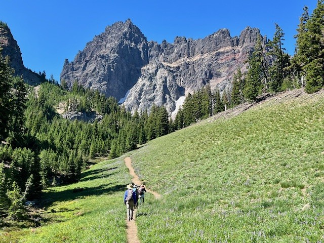
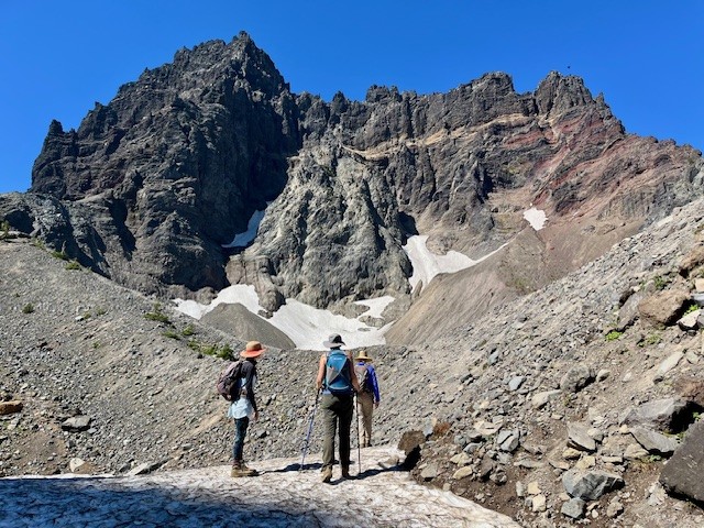
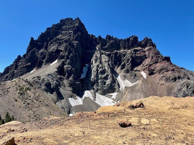
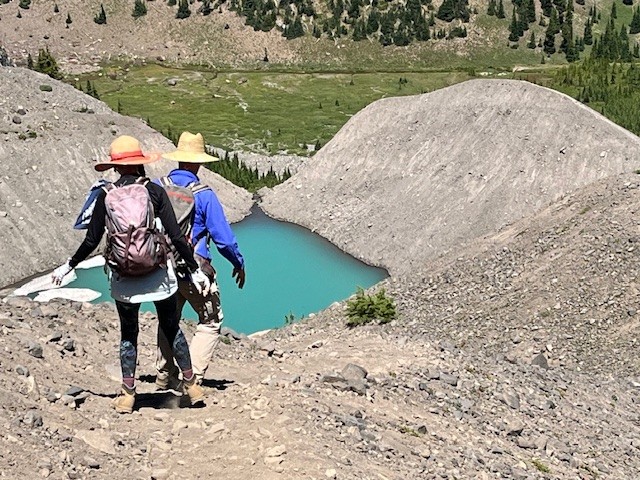
The heavy snow experienced during the winter of 2024-2025 delayed the opening of the most popular Central Oregon hikes until later in the summer. However, the heavy snow also provided extra moisture in the soil which has resulted in a fabulous wildflower season. Among the best areas for wildflowers in the Central Oregon Cascades is Canyon Meadow, part of the hike to the base of Three Fingered Jack. Canyon Meadow hike is a moderate loop that takes hikers from Jack Lake to the meadow and then returns through the burned forest resulting from 2003's B & B complex fire. However, for those wanting a more challenging hike, taking the unmaintained spur from Canyon Meadow to Three Fingered Jack provides for spectacular views and a tough scramble up the moraine of Jack Glacier (unofficial name) which is mostly gone. The aqua blue of the glacial lake was especially stunning the beginning of August. Hikers can climb the moraine until they reach the ridge connecting Three Fingered Jack with the unnamed colorful hoodoo next to it. The flat top of the ridge can be a great location for lunch or a snack before taking the slow trek down the moraine back to the more established trail. There is a side trail that can be taken to the upper meadows following the stream which exits the moraine. The upper meadow was stunning with blooming wildflowers the beginning of August. Once the lower meadow is reached, the loop back to Jack Lake can be taken, although much of this is in burned forest. Another option is to return the way hikers arrived at Canyon Meadow rather than continuing the loop through the burned forest. This will add elevation and distance, however.
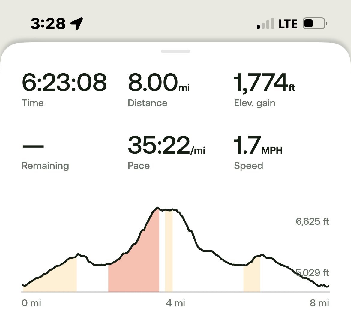
All in all, for those not taking the loop but returning the way to Jack Lake that they arrived at Canyon Meadow, the entire hike is roughly 8 miles and just shy of 1800 feet of elevation gain.
 |
 |
 |
 |
 |
 |
Privacy Policy / DMCA Notice / ADA Accessibility