

Posts in category 'Great Oregon Hikes'
Subscribe and receive email notifications of new blog posts.
 RSS Feed
27
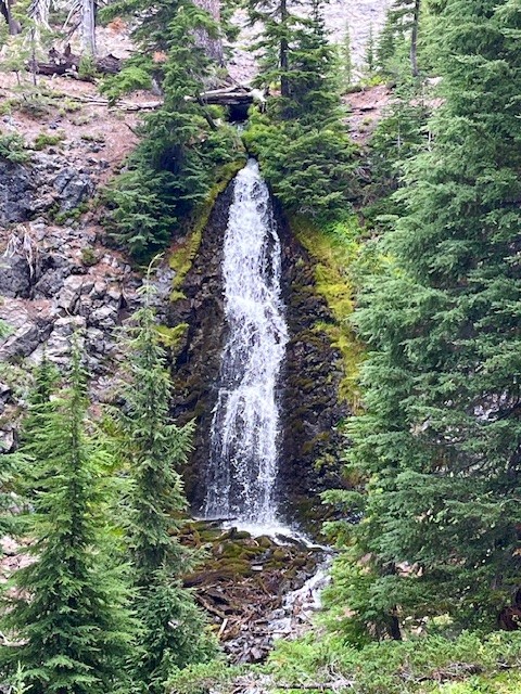
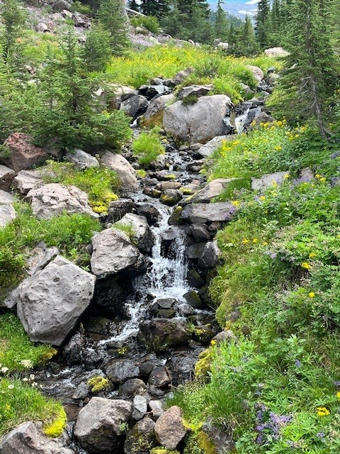
The Obsidian Trail is Stunning in 2025
The Obsidian Trail is a Favorite Central Oregon Hike
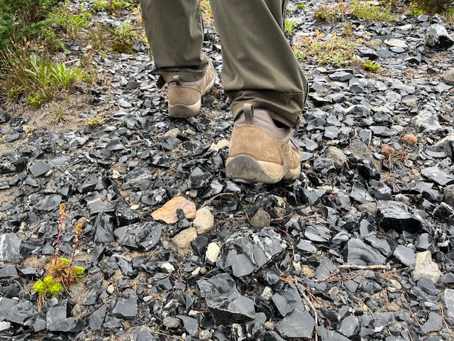
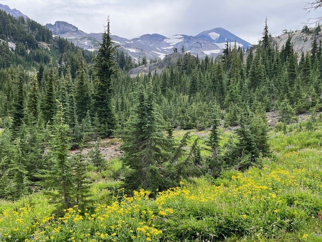
Before the National Forest Service required passes in 2021 for the most popular Central Oregon hikes, the Obsidian Trail had such a huge demand that trail passes were in place for many years earlier. The Obsidian Trail takes hikers from the trailhead off the seasonal McKenzie Pass Highway 242 up to the Pacific Crest Trail and through an area known for the obsidian rock that covers the ground. Before reaching the rock, hikers pass through wooded forest, climb lava flows, travel by Obsidian Falls and then reach the relatively flat land of the obsidian area.
 |
 |
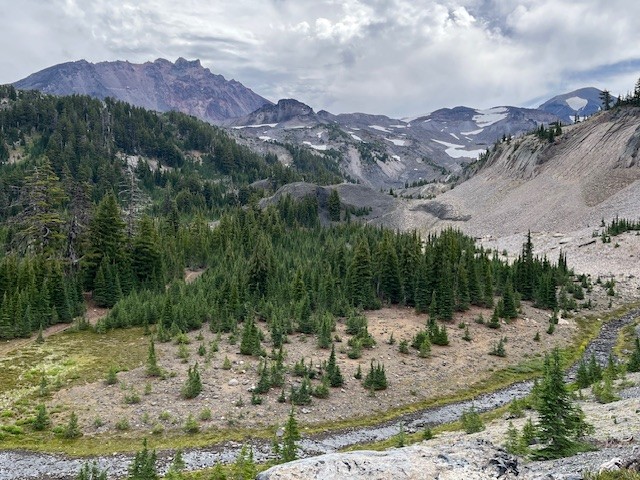
There is a beautiful view point overlooking the climbing trail which some may take to summit Middle Sister. It is a logical place to stop and enjoy a snack or lunch before proceeding on to an area known as Sunshine which was a place many Pacific Crest Trail hikers or those planning to summit Middle Sister early morning would spend the night. Currently that location is undergoing restoration and not available for camping.
 |
 |
All in all, for those who wish to hike the loop from the Obsidian Trailhead, travel to Sunshine and return via Glacier Way (a side path that joins with the Pacific Crest Trail and avoids Obsidian Falls), the entire trek will cover about 11.5 miles and have over 2100 feet of elevation gain.
 |
 |
12
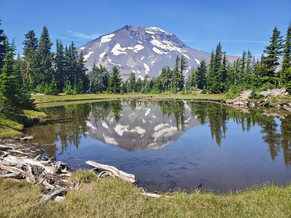
Hidden Treasures in the Three Sisters Wilderness in the Central Oregon Cascades
Leave the Path to Find Little Seen Tarn Lakes Above Green Lakes
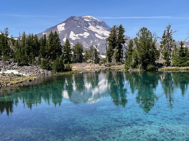
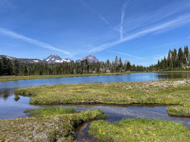
There are hidden treasures in the Three Sisters Wilderness which can be found for those willing to leave the path and follow a compass or GPS to locate them. In particular, there are several beautiful tarn lakes located roughly a half mile off the Green Lakes trail which connects the Green Lakes valley with Park Meadow over the pass between South Sister and Broken Top. There is no path to these lakes, but people good with following a downloaded map can find them. The first four lakes can mirror views of South Sister and their general location can provide views toward Golden Lake as well.
 |
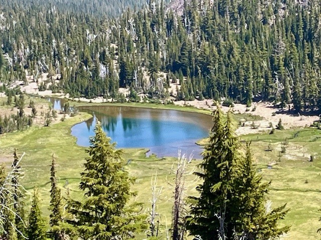 |
Past the four lakes walking toward Broken Top, hikers can follow a general topography line on a map and find the other two tarn lakes located just below Broken Top. These two lakes can more easily be accessed by following the path next to the creek which flows into Golden Lake. Both of these tarn lakes are located in a cirque bordered by a moraine. On the lower lake, the beautiful blue water was flowing over the top of the moraine forming a waterfall flowing into the creek below in early August 2025. At other times, the water which flows into the creek comes out of a spring at the base of the moraine. At the upper lake, sometimes the voices of people on the top of the ridge overlooking Broken Top's No Name Lake can be heard, although they are not seen due to obstruction from topography and vegetation.
 |
 |
The more direct route back to the trail is following the path down the creek to Golden Lake and from there, rejoining the Green Lakes Trail. Hikers can either return to Green Lakes over the pass or travel northeast to Park Meadow and from there to the Park Meadow trail head near Three Creeks. This second option will involve hiking through over 4.5 miles of burned forest, however. Both methods can be done in a long day, those coming from Green Lakes hiking over 18 miles and those coming from Park Meadow close to 17 miles. Others could pack in camping supplies and better explore and enjoy the day in the area.
 |
 |
7
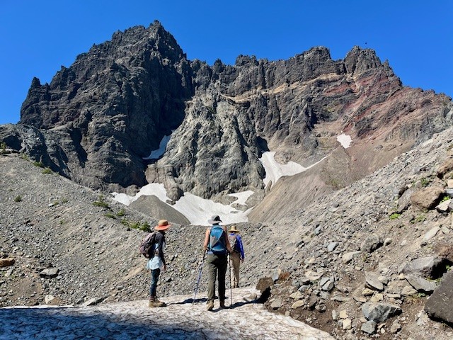
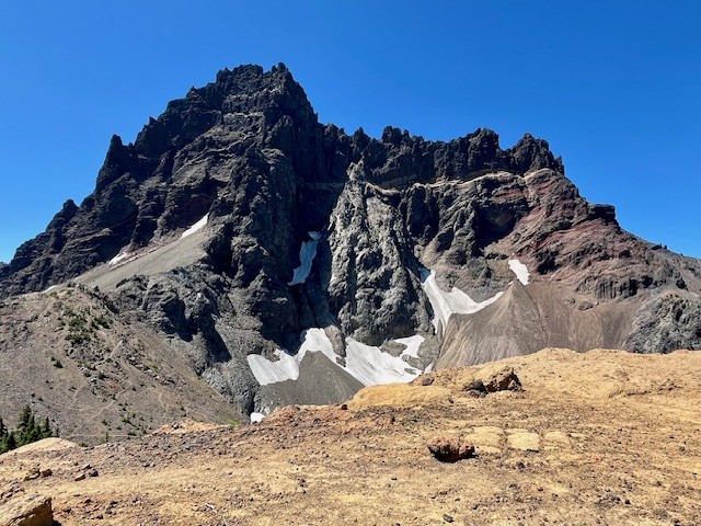
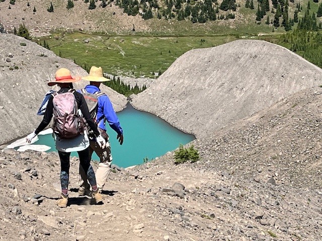
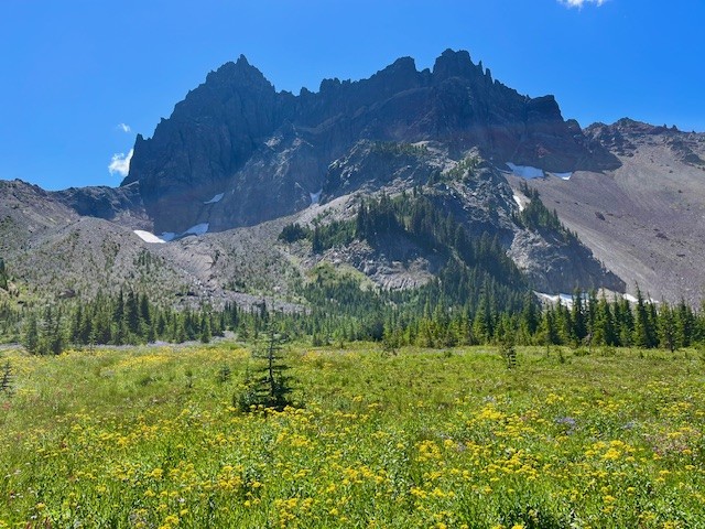
Canyon Meadow and Three Fingered Jack are Wonderful Summer Central Oregon Hikes
The Wildflowers are Abundant in Central Oregon's Canyon Meadow in the Mt. Jefferson Wilderness
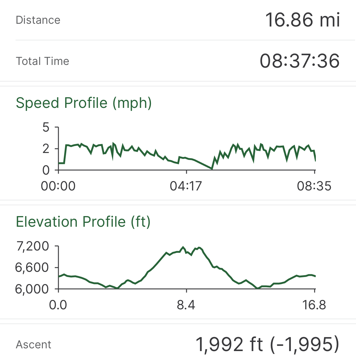
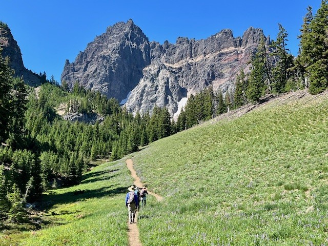
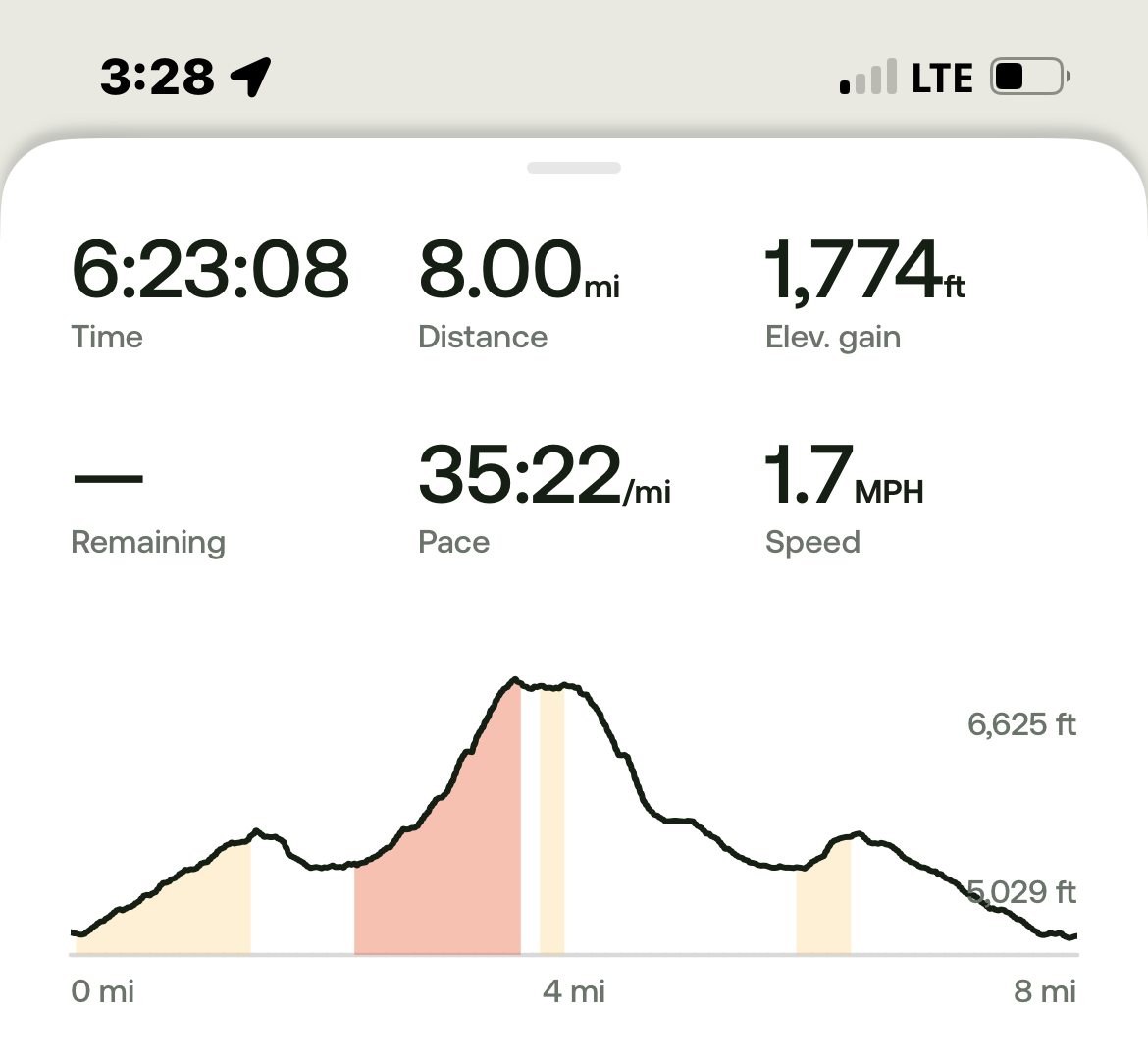
The heavy snow experienced during the winter of 2024-2025 delayed the opening of the most popular Central Oregon hikes until later in the summer. However, the heavy snow also provided extra moisture in the soil which has resulted in a fabulous wildflower season. Among the best areas for wildflowers in the Central Oregon Cascades is Canyon Meadow, part of the hike to the base of Three Fingered Jack. Canyon Meadow hike is a moderate loop that takes hikers from Jack Lake to the meadow and then returns through the burned forest resulting from 2003's B & B complex fire. However, for those wanting a more challenging hike, taking the unmaintained spur from Canyon Meadow to Three Fingered Jack provides for spectacular views and a tough scramble up the moraine of Jack Glacier (unofficial name) which is mostly gone. The aqua blue of the glacial lake was especially stunning the beginning of August. Hikers can climb the moraine until they reach the ridge connecting Three Fingered Jack with the unnamed colorful hoodoo next to it. The flat top of the ridge can be a great location for lunch or a snack before taking the slow trek down the moraine back to the more established trail. There is a side trail that can be taken to the upper meadows following the stream which exits the moraine. The upper meadow was stunning with blooming wildflowers the beginning of August. Once the lower meadow is reached, the loop back to Jack Lake can be taken, although much of this is in burned forest. Another option is to return the way hikers arrived at Canyon Meadow rather than continuing the loop through the burned forest. This will add elevation and distance, however.
All in all, for those not taking the loop but returning the way to Jack Lake that they arrived at Canyon Meadow, the entire hike is roughly 8 miles and just shy of 1800 feet of elevation gain.
 |
 |
 |
 |
 |
 |
28
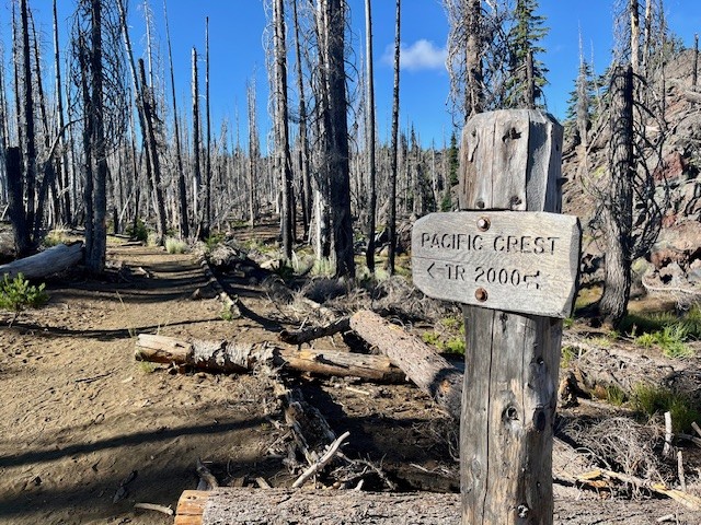
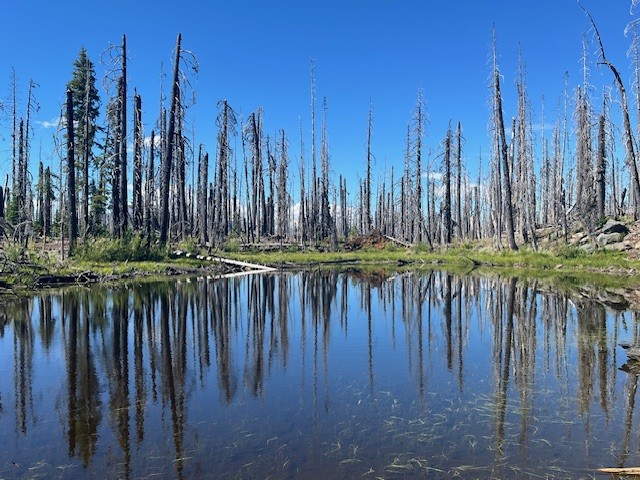
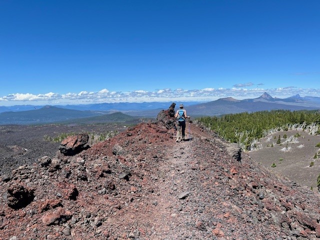
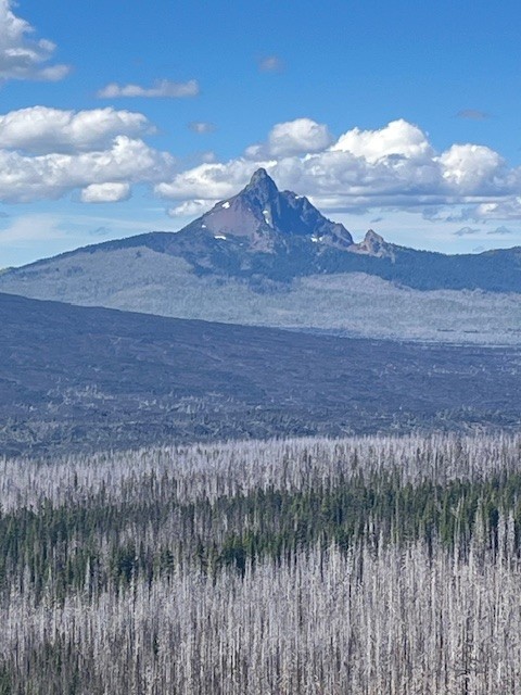
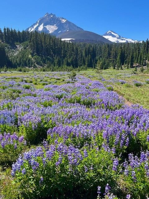
Collier Cone and Collier Glacier is a Challenging Central Oregon Hike on the Pacific Crest Trail
The Pacific Crest Trail Abuts Collier Cone
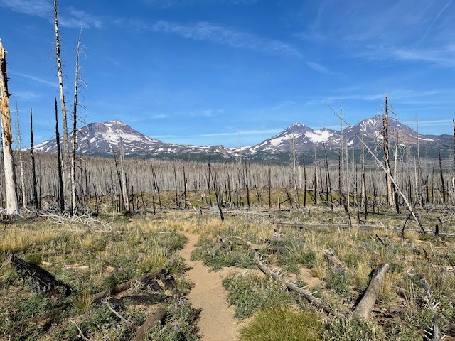
It is estimated that hundreds of thousands of people hike sections of the Pacific Crest Trail each year, but only a few hundred succeed in completing the entire 2650 +- miles. In Central Oregon, the PCT runs next to the Cascade Mountains, with sections on the east side and other sections on the west side of the seven prominent peaks. Collier cone is next to North Sister with Collier Glacier lying in the saddle between North and Middle Sister abutted on the west by Little Brother. Over the years the glacier has been in retreat with the greatest loss prior to 1950. The wet winter and cooler spring experienced in 2025 compared with 2023 appears to reflect more snow and more water in the glacial lake later in the summer.
Access to Collier Cone can be found through hiking the Obsidian Trail, Four in One Cone, or through Lava Camp Lake. All approaches come with at least seven miles one direction which is why there are few people who visit Collier Glacier. Even though the PCT runs right next to Collier Cone, climbing to the moraine bordering the lake takes another third of a mile one direction, which is probably why few PCT hikers take the time to see the view.
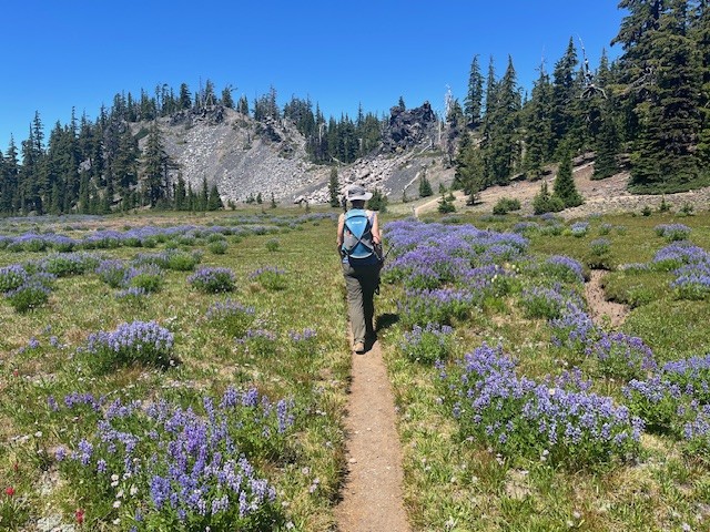
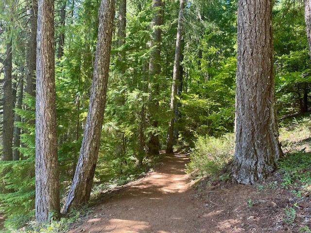
The hike from Lava Camp Lake starts in burned forest, the result of 2017's Milli Fire. However, there remains untouched forest near Matthieu Lakes and the lava fields were natural fire breaks. The meadow, which is the junction for Scott Trail and the PCT, was stunning in July 2025 with the lupines at their peak. California tortoiseshell butterflies were abundant and filled the dry stream beds in the meadow and circled in groups by the lava fields. The total in and back hike from Lava Camp Lake is 15 miles with 2400 feet of elevation gain.
 |
 |
 |
 |
 |
 |
24
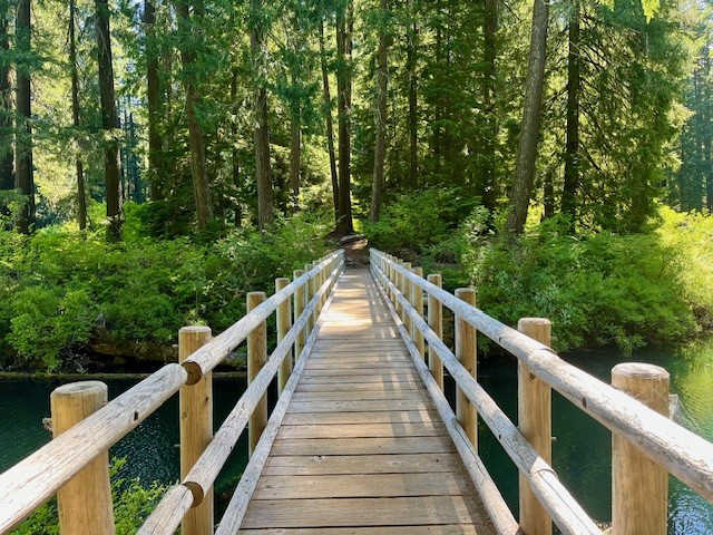
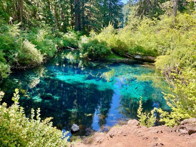
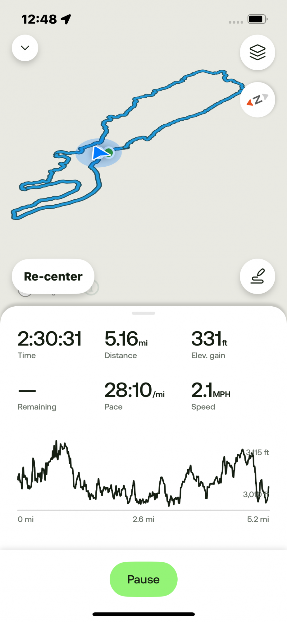
Clear Lake is an Easy Summer Hike
For those looking for an easy summer hike in the Cascades, it is hard to beat Clear Lake. Better known as a great hike for fall color, it can be enjoyable to spend a few hours hiking the five plus mile loop around Clear Lake in the summer. It is during the warm summer months that many families drive to Clear Lake to enjoy the beautiful water with their rowboat, kayak, paddle board or other floating device; motorized vehicles are not permitted on the lake. While hiking the easy path, it can be fun to watch the young families fishing or paddling around the lake and enjoying the food at the resort. There are year-round cabin rentals available as well as camping. Run by the Linn County Parks & Recreation, the resort is located in the Willamette National Forest and the lake contains the headwaters of the McKenzie River via a percolating spring at the far end of the lake. The lake was formed 3000 years ago when lava from Sand Mountain backed up the river forming the lake. The remnants of the flooded forest are still visible 120 feet underwater and have not fully rotted in all the centuries due to the extreme chill of the lake.
 |
 |
 |
 |
Privacy Policy / DMCA Notice / ADA Accessibility